How-To
The Map gives you a satellite view of your farm with your Yards and Fields drawn on top, so you can see everything geographically instead of just as a list.
-
Open Map from the sidebar. Yards load as your current, live Storage setup; they aren't tied to a crop year. Fields load based on the crop year currently selected.

-
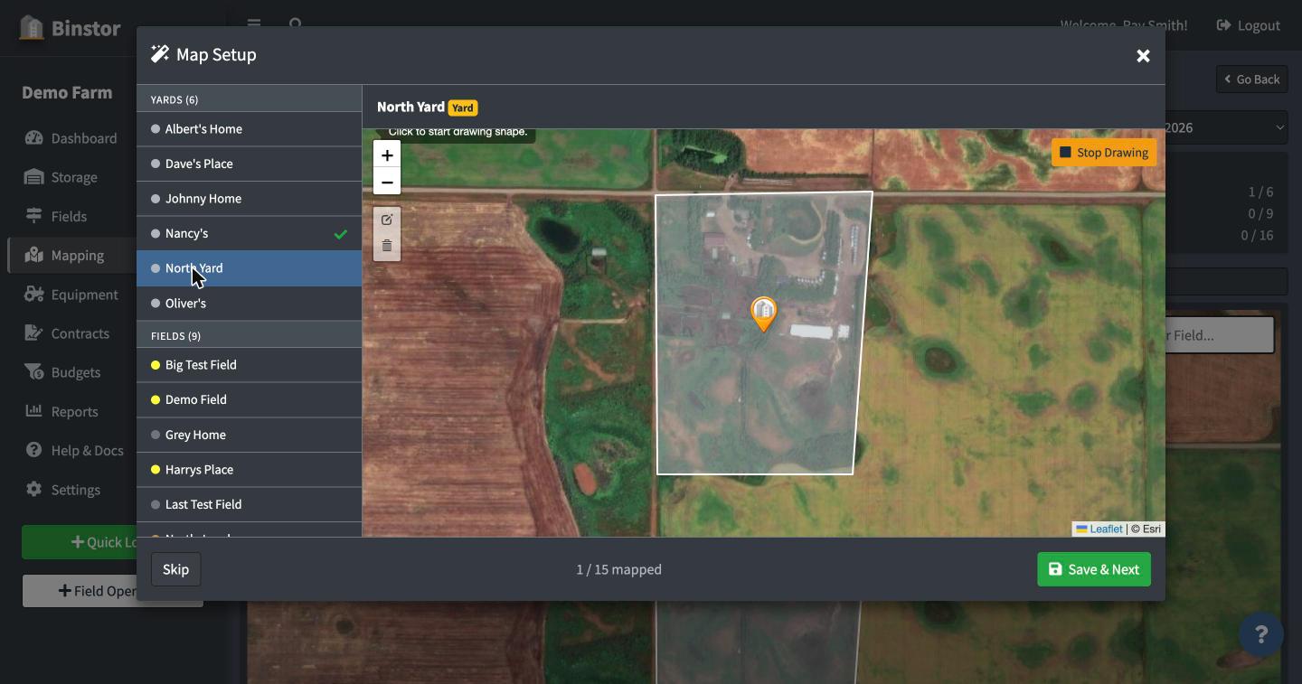
Drawing a boundary: click Configure Map, pick a Yard or Field from the sidebar list, then use the draw tool to trace its outline directly on the satellite imagery. Binstor calculates acreage from the shape you draw.
-
Click any drawn shape to see its details and jump straight to that Field or Yard's page.

-
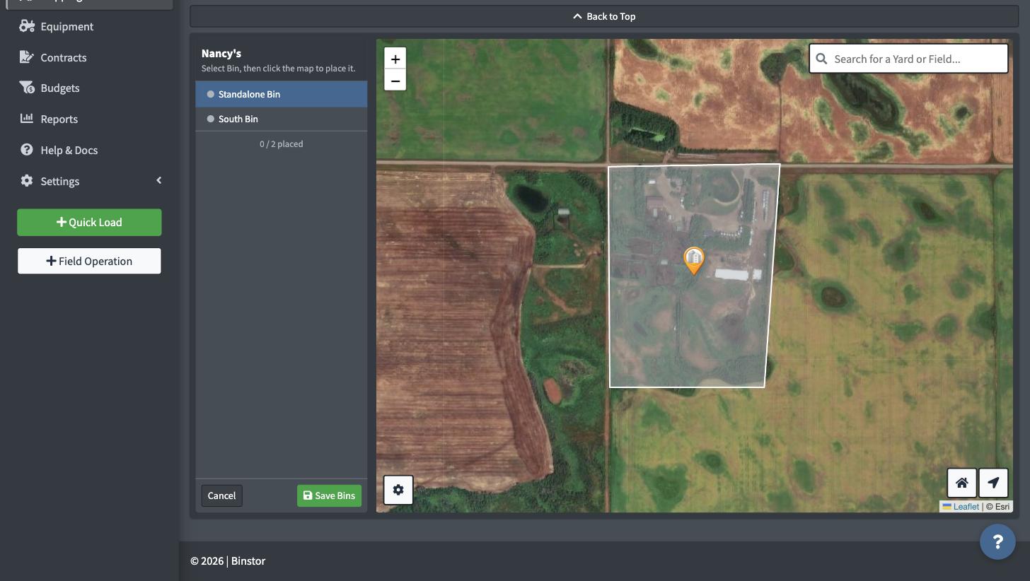
Bins within a Yard can be positioned on the map individually, which is useful for yards with several bins laid out in a specific arrangement. Open the Yard's popup and click Place Bins, then pick a bin from the list and click the map to set its position.
-
Use the Notifications & Help widget (bottom-right, every page) to reach us with anything that looks wrong with the mapping tools.
FAQ
I can see Fields but not Yards on the Map (or vice versa). Staff accounts need View Storage and/or View Fields permission to see those layers on the Map. If you're missing one, that whole layer won't show, even though the rest of the Map still loads.
Can I map a Field I haven't created yet? No, create the Field (or Yard) first, then draw its boundary on the Map. The drawn shape links to the Field/Yard record, it isn't a separate object.
Do commodity colors on the map change year to year? Yes, commodities are assigned to Fields per crop year, so a field's color on the map reflects whatever's planted in the year you currently have selected.